Take part in the Seabed 2030 survey – closes end of April
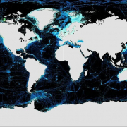
Source: NLA International on behalf of Seabed 2030
Last year NLA International Ltd working on behalf of Seabed 2030, launched an online survey to find out more about the status and potential of mapping the ocean floor. The survey collected views from across all interested sectors to help us better understand issues such as:
- Why stakeholders feel it is important to map the seabed.
- How interested parties are estimating the environmental, social and economic value of seabed mapping.
- Where are the most urgent priorities for seabed mapping.
All of this will help us to corroborate – or challenge – existing thinking, and hopefully identify any areas of the seabed that may benefit from a more joined-up / collaborative approach.
We have been really delighted with the responses thus far – we have received nearly 470 detailed responses to date – and are currently hard at work analysing the initial findings.
However, it is not too late to have your say! We will be keeping the survey open until the end of April, and we would be very grateful if you could contribute your views.
To access the survey, please click here.
More information
Read the article: Marine Geospatial Data: the Cornerstone of the Blue Eonomy
Read more about the seabed 2030 Initiuative: 100% of Ocean Floor mapped by 2030